Salt Lake City, Utah
Recognized across the world as a premier skiing destination with resorts like Snowbird, Alta, and Park City less than an hour from the airport, Salt Lake City's Wasatch Front is also home to word-class hiking, rock climbing, mountain biking, backpacking and camping. Plus, you're never more than a few hours' drive from other Utah adventure playgrounds like Moab, Zion National Park, and the Uinta Mountains.
Top Spots in and near Salt Lake City
-
Salt Lake City, Utah
Ensign Peak
4.20.97 mi / 354 ft gainThis hike is a piece of cake with a sizable reward. It starts just up the hill behind the Capitol Building and ascends 350 feet over about 0.5 miles to the top on a very well marked trail. It's great for a family with young ones or maybe a quick post-dinner evening date. Parking is all along a re...Read more -
Salt Lake City, Utah
Cycle City Creek Canyon
5.0City Creek Canyon is a hidden gem, just minutes away from downtown Salt Lake City. Secluded winding roads will take you deep into the canyon, away from the bustling city. The sounds of the creek, canyon views, and the thick forest that lines the road provide for the perfect, quick escape.Starting...Read more -
Salt Lake City, Utah
Mount Van Cott via Red Butte Canyon
4.02.33 mi / 1211 ft gainThere are many different trailheads that will take you to the top of Mount Van Cott, but the main trailhead is up Red Butte Canyon. Drive up the canyon until you reach the parking lot where the canyon gate is blocking the road. After parking your car here, head up the dirt road on foot until you ...Read more -
Salt Lake City, Utah
Hike the Living Room
4.42.5 mi / 1000 ft gainBecause if its proximity to downtown Salt Lake, this is a great quick hike to do after work. Although it's short, it is fairly steep, climbing nearly 1000 feet in 1.25 miles. However, most people can do it without too much difficulty. This is a good family hike and allows dogs on leashes. Due to ...Read more -
Salt Lake City, Utah
Hike or Run Mount Wire
3.74.5 mi / 2082 ft gainThis 4.5 out-and-back trail starts just south of the Natural History Museum at the University of Utah. Park in the museum parking lot and walk up the stairs to the Bonneville Shoreline Trail. Then head south along the BST for a few minutes until you reach a big yellow sign with 174 on it. Turn le...Read more -
Salt Lake City, Utah
Bike Emigration Canyon
4.714.4 mi / 1300 ft gainIf you're looking for a fun climb on your road bike that won't kill you, or you are trying to find a place to train for some bigger climbing, Emigration is the perfect place to ride. The elevation gain is gradual, allowing you to grind it out for a great training ride, or spin steadily to the top...Read more -
Salt Lake City, Utah
Cycle Big Mountain
The views from the top of Big Mountain are breathtaking. From the Salt Lake - Morgan County border at about 7,400 ft, you will look down East Canyon, and over the top of Parley's Canyon into the Salt Lake Valley. Big Mountain can be ridden alone or as an extension to the Emigration Canyon Ride.Fr...Read more -
Salt Lake City, Utah
Hike Jacks Mountain
4.02.4 mi / 1300 ft gainNamed for a toddler who died of Lukemia in 1995, Jacks Mountain is a beautiful place to sit above the valley and contemplate mortality. On the peak, you’ll find a couple mailboxes containing heartfelt notes from hundreds of hikers throughout the years. It’s the kind of place that restores your fa...Read more -
Salt Lake City, Utah
Parley's Historic Nature Park Trail Loop
3.02 mi / 135 ft gainParley's Historic Nature Park Trail Loop, located in Salt Lake City, Utah, is a well-known hiking trail. This 2-mile loop trail is rated as moderate, making it suitable for hikers with some experience. The trail is primarily used for hiking, walking, and nature trips and is accessible year-round....Read more -
Bountiful, Utah
Backpack to Rudy's Flat
4.07 miRudy's Flat is a great overnight hike with plenty of tent or hammock space and multiple established fire rings. This hike offers multiple options for distance depending on your availability and skill level.From the Mueller Park Canyon trailhead (5,234 ft), hikers will experience a gradual ascent ...Read more -
Bountiful, Utah
Trail Run to Elephant Rock
4.47 mi / 1025 ft gainMueller Park is a beautiful, quaint canyon, with some sweeping up canyon views throughout the ascent. The trail is a fun, family friendly single track from the bridge all the way to the rock. You will pass a bald strip (pipeline) that runs North to South which marks about halfway to the rock. At ...Read more -
Bountiful, Utah
Mountain Bike to Elephant Rock
5.0Mueller Park is a beautiful, quaint canyon, with some sweeping up canyon views throughout the ascent. The trail is a fun, flowy, well maintained single track from the bridge all the way to the rock. You will pass a bald strip (pipeline) that runs North to South which marks about halfway to the ro...Read more -
Salt Lake City, Utah
Grandeur Peak West Face
2.23 mi / 3307 ft gainAre you planning a big adventure and need a boost getting ready for it? You came to the right place. This is my go-to when I’m preparing to climb a big mountain. It’s hard to find a steeper trail in the area (that’s not a game trail), and the West Face is usually free of snow early in the season....Read more -
Salt Lake City, Utah
Hike Mt. Aire
4.54 mi / 2000 ft gainMount Aire, standing around 8600 ft, certainly isn't the most inspiring peak in or around Salt Lake City, but to me it serves as a quick summit to catch the sunset when I'm short on time.Getting There:Start by heading up Mill Creek Canyon Rd. After passing the ranger booth, drive about 5.5 miles ...Read more -
Salt Lake City, Utah
Climb West Slabs of Mount Olympus
5.0Park at the top of Thousand Oaks Drive, and make your way to the dirt path heading east. It will be a well maintained, well-covered single dirt track which takes you to the base of a really impressive couloir. Follow the trail until you reach the couloir / rocky gully. You will then see the West ...Read more -
Centerville, Utah
Hike to the Rope Swing on Deuel Creek Trail
5.02.6 mi / 646 ft gainNot only is this hike absolutely gorgeous, but it also has an epic rope swing at the end! To get to the trailhead you'll need a vehicle that can handle rough roads—you have to drive up a bit on the side of the mountain to get to the trailhead. The beginning of the hike is marked with a little bul...Read more
Camping and Lodging in Salt Lake City
Salt Lake City, Utah
Salt Lake City KOA Holiday
This KOA is the RV park closest to downtown Salt Lake City. Enjoy a traditional camping experience along with easy access to all the city...
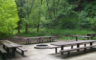
Bountiful, Utah
Mueller Park Group Picnic
Overview
Mueller Park Group Picnic Area is located just 5 miles from Bountiful, Utah, at an elevation of 5,400 feet. Visitors enjoy relax...
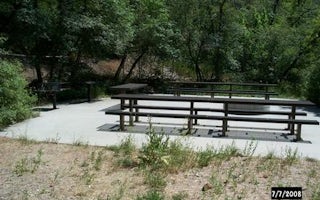
Cottonwood Heights, Utah
Dogwood Day Use
Overview
Dogwood Day Use Picnic Area is just 2 miles up Big Cottonwood Canyon, conveniently close to Salt Lake City. Big Cottonwood Creek...
Salt Lake City, Utah
Storm Mountain
Overview
Storm Mountain Day Use Area is just 3 miles up Big Cottonwood Canyon, conveniently close to Salt Lake City. Big Cottonwood Creek...
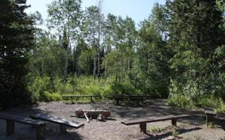
Morgan, Utah
Bountiful Peak Campground
Overview
Bountiful Peak Campground is set in an alpine basin high in the Wasatch Mountains at an elevation of 7,500 feet. Farmington, Uta...
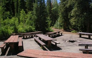
Salt Lake City, Utah
Jordan Pines
Overview
Jordan Pines Campground is located in scenic Big Cottonwood Canyon at an elevation of 7500 feet. Salt Lake City is conveniently ...


