Squirrel Meadows Cabin
Book this listing through our partner Recreation Gov
About Squirrel Meadows Cabin
Overview
Squirrel Meadows Cabin is located 24 miles east of Ashton, Idaho, just off the Ashton-Flagg Ranch Road. The current cabin was built in 1934, but the site has been used for administrative purposes since 1907. It's listed on the National Register of Historic Places. Only one other cabin in Wyoming was constructed with the same building plan. The 2-room cabin is made of lodgepole pine and features a wood shingled roof.Recreation
The cabin provides access to a variety of year-round recreational activities, including horseback riding, cross-country skiing and snowshoeing. Berry picking is available in late summer. Some of the other activities located within a few miles include off-road vehicle and motorcycle riding, snowmobiling, hiking and mountain biking. Game and game bird hunting is a popular pastime in season.Facilities
This cabin sleeps six and provides bunkbeds, mattresses, a wood stove for cooking, table and chairs, and firewood. A hand pump, vault toilet, picnic table and horse corrals are located outside. Electricity is not provided. Guests may wish to bring battery or propane-powered lighting. Bedding, matches, and emergency items like a first aid kit are not provided. Trash bags are needed to pack out garbage.Natural Features
Squirrel Meadows Cabin is situated at 6,500 feet on the Yellowstone Plateau of southwest Wyoming. The cabin sits in a meadow surrounded by pine trees. Guests can enjoy views of the distant mountains. Wildlife in the area includes black bear, wolf, elk, moose, mule deer, and grizzly bear.Nearby Attractions
Squirrel Meadows Cabin Reviews
Have you stayed here? Be the first to leave a review!
Top Spots in or near Alta
Photograph Cave Falls
Yellowstone National Park, Wyoming
3.5
Cave Falls is one of the hidden waterfalls of Yellowstone National Park that really only the natives know about. Although Cave Falls originally derived its name from a cave next to the waterfall, the cave has since collapsed and is no longer accessible. Known for its enormous length of 250 feet, the waterfall stretches across the entire Fall River, which is terrific for fishing. Before arriving...
Dunanda Falls via Boundary Creek Trail
Yellowstone National Park, Wyoming
4.5
16.56 mi
/ 771 ft gain
You'll start at the Bechler Ranger Station and take the Boundry Creek Trail. Depending on which camp site you reserve your hike will be anywhere from 5-9 miles. We camped at site 9A1 5 miles from the ranger station. Hiking to waterfall is 16+ miles round trip
Your feet will get wet on this hike, so Chacos or waterproof boots will be necessary, however in couple places the water crossings can g...
Union Falls and Scout Pool
Alta, Wyoming
5.0
15.42 mi
/ 1755 ft gain
Of a summer spent living in Yellowstone, and many overnight trips in the park, the trek to Union Falls and Scout Pool ranked at the top of my list. (Many of my fellow gas station employees agreed!) The hike itself is nothing spectacular, but takes you to two of the most beautiful places in the park that most people will never see (or even hear about). If you have an extra day or two in Yellowst...
Camp at Lizard Creek Campground
Moran, WyomingThis gem of a campground was discovered in desperation after all the campsites were booked at Yellowstone. There are 60 sites with relatively clean bathrooms. The sites are large with optimal privacy from your neighbors. If you're lucky enough you can even snag campsites steps from the lake. There are plenty of trees throughout the campground, with each site equipped with a picnic table, bear l...
Mesa Nature Trail
Ashton, Idaho
5.0
2.44 mi
/ 236 ft gain
The Mesa Nature Trail begins on the dirt road to the Upper Mesa Falls overflow parking lot. The first mile of the trail is wide and smooth. Pause a half mile in to admire the Henry's Fork from the top of a lava field.
The trail terminates at a flat bluff overlooking the top of Upper Mesa Falls. To get closer, follow the narrow trail that heads north from the bluff.
The trail, steep and cover...
Upper and Lower Mesa Falls Loop
Ashton, Idaho
4.8
2.6 mi
/ 358 ft gain
When two waterfalls have their own scenic byway, you know it is worth the additional stop. Lower Mesa Falls and Upper Mesa Falls are spectacular waterfalls along the Henrys Fork River, deep in the Grand Targhee Forest. The winding scenic byway yields some spectacular views of the Grand Targhee Forest, especially during fall when all the quaking aspens and other trees are changing colors. In win...
Camping and Lodging in Alta
Ashton, Idaho
Warm River
Overview
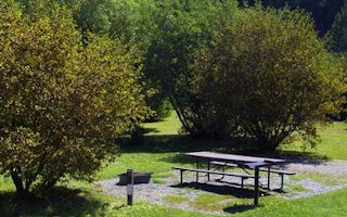
Warm River Campground is located on its namesake in the Caribou-Targhee National Forest of southwestern Idaho. Visitors love the...
Ashton, Idaho
Warm River Cabin
Overview
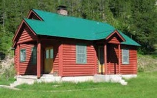
Warm River Cabin is located less than 20 miles from Ashton, Idaho, at Warm River Springs. An Idaho fish and game hatchery operat...
Ashton, Idaho
Grand View
Overview
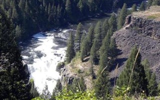
Grand View Campground is located on the Mesa Falls Scenic Byway, adjacent to the Lower Mesa Falls Overlook, approximately 13 mil...
Alta, Wyoming
Teton Canyon
Overview
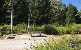
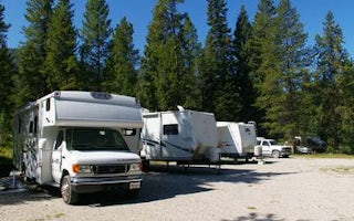
Teton Canyon Campground is located in beautiful Teton Canyon at an elevation of approximately 6,500 feet. Driggs, Idaho is just ...
Alta, Wyoming
Reunion Flat
Overview
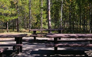
Reunion Flat Campground is located in beautiful Teton Canyon in the Caribou-Targhee National Forest. Hiking, backpacking and hor...
Yellowstone Branch Line Trail
Big Springs Warming Hut
Overview
Big Springs Warming Hut is located 22 miles south of West Yellowstone, Montana in beautiful Island Park, Idaho at an approximate...
Unfortunately, we don't have up-to date pricing data for this listing, but you can check pricing through Recreation Gov.
Book NowAdd your business today to reach The Outbound's audience of adventurous travelers.
Community
© 2025 The Outbound Collective - Terms of Use - Privacy Policy


