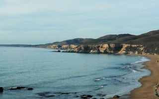
Santa Rosa, California
Santa Rosa, California is a popular area for outdoor adventurers and those who love to explore nature. With its scenic trails and activities, it's a must-visit for anyone looking for an adventure. Popular attractions include the Santa Rosa Creek Trail, Spring Lake Regional Park, and the Laguna de Santa Rosa Trail. These trails provide visitors with the chance to discover the area's natural beauty. For those seeking more of a challenge, the Annadel State Park is ideal for a hike. The park also offers great views of the surrounding area. For a more leisurely activity, the Trione-Annadel State Park is an excellent spot for a stroll. The park is full of wildlife and provides many opportunities to observe the area's wildlife. No matter what type of outdoor activity you're looking for, Santa Rosa has something for everyone.
Top Spots in and near Santa Rosa
-
Santa Rosa, California
Western Route to Eastern Route Loop
2.26 mi / 535 ft gainThe Western Route to Eastern Route Loop in Santa Rosa, California, is a 2.3-mile moderately challenging trail popular for its scenic views and diverse landscape. The loop offers a steady ascent, rewarding hikers with panoramic vistas of Sonoma County and lush natural surroundings. It’s known for ...Read more -
Santa Rosa, California
Taylor Mountain Loop
4.34.86 mi / 1076 ft gainFrom the northern entrance to the park, you can access an 18-hole disc golf course as well as a number of trails. The Eastern Trail takes you up a steep 1,000 feet to the top of Taylor Mountain, where you can see most of Sonoma County laid out before you. Mt. St. Helena is visible in the distance...Read more -
Santa Rosa, California
Canyon Trail to Spring Creek Trail Loop
5.07.39 mi / 728 ft gainThe Canyon Trail to Spring Creek Trail Loop is a popular hiking route in Trione-Annadel State Park in Sonoma County, California. This loop offers a mix of shaded woodland paths and open trails, making it a favorite for hikers and outdoor enthusiasts. Trail Highlights: Length & Difficulty: A...Read more -
Santa Rosa, California
Joe Rodota Trail
4.512.67 mi / 174 ft gainJoe Rodota Trail is an out-and-back trail where you may see wildflowers located near Sebastopol, California.Read more -
Santa Rosa, California
Santa Rosa Creek Trail: Willowside Road to Fulton Road
4.2 mi / 46 ft gainThe Santa Rosa Creek Trail segment from Willowside Road to Fulton Road offers a delightful 2.3-mile journey through one of Santa Rosa's most accessible urban nature corridors. This well-maintained paved trail provides cyclists, walkers, and runners with a scenic route that perfectly balances natu...Read more -
Larkfield-Wikiup, California
Creekside Trail to Canyon Trail to Ridge Trail Loop
4.54.46 mi / 850 ft gainThe Creekside Trail to Canyon Trail to Ridge Trail Loop offers an immersive 5.1-mile adventure through the heart of Annadel State Park (now part of Trione-Annadel State Park) in Santa Rosa, California. This moderately challenging loop showcases the park's diverse landscapes, from shaded creek c...Read more -
Sebastopol, California
Laguna de Santa Rosa Loop Trail
4.03.95 mi / 115 ft gainThe Laguna de Santa Rosa Loop Trail offers an enchanting 3.95-mile nature experience just outside of downtown Sebastopol, California. This easy-to-moderate trail provides visitors with a unique opportunity to explore the largest freshwater wetlands complex on the northern California coast, making...Read more -
Santa Rosa, California
Hood Mountain Summit Via Lower and Upper Johnson Ridge Trails
5.95 mi / 2054 ft gainHood Mountain Summit via the Lower Johnson and Upper Johnson Ridge Trails is a 6 mile out-and-back trek located in Santa Rosa, CA. The trailhead starts at the Pythian Road parking lot, accessed from Highway 12. The hike takes 3.5 to 4 hours to complete and is considered strenuous. All trails are...Read more -
Santa Rosa, California
Gunsight Rock via Hood Mountain Trail
5.07.91 mi / 2372 ft gainHike to Gunsight Rock through Hood Mountain Regional Park to get a view overlooking Sonoma and Napa Valley. In order to get to the trailhead take Highway 12 to Los Alamos Rd, the road will then turn into Timberline Dr, this will take you to the trailhead. There is a parking fee of $8. From the p...Read more -
Sebastopol, California
Ives Park
4.0Ives Park is the oldest park in Sebastopol, California, and is located only 2 blocks from downtown Sebastopol. The park has many picnic tables with barbecues, a baseball diamond, a playground, and a community pool. Amenities: Parking for the park is on the street surrounding the park. There is ...Read more -
Santa Rosa, California
Crane Creek Canyon Loop
4.01.4 mi / 154 ft gainWith multiple loops of varying length, this park is great for anyone looking for a casual hike around a beautiful area in the foothills of Rohnert Park. Crane Creek has nice secluded picnic areas next to the creek in the cover of willow, alder, buckeye and bay trees. There's also an 18-hole disc ...Read more -
-
Sebastopol, California
Ragle Ranch Extended Loop
5.01.86 mi / 82 ft gainRagle Ranch Extended Loop is a loop trail where you may see local wildlife located near Sebastopol, CaliforniaRead more -
Sebastopol, California
Blackberry - Thistle Loop
5.01.45 mi / 69 ft gainThe Blacberry - Thistle Loop is a relatively easy hiking trail at Ragle Ranch park. This trail is used for hiking and running and offers some cover/shade as well as great views of foliage especially in the fall months. This trail is located on the west side of Sebastopol, California. The park i...Read more -
Kenwood, California
Pony Gate-Canyon Loop
4.02.17 mi / 568 ft gainThe Pony Gate-Canyon Loop within Sugarloaf Ridge State Park is a new favorite of mine on my list of family and kid-friendly hikes. Our little girls did great with this hike and loved it. If you can get moving early in the day and begin your hike around breakfast time, you might find there are few...Read more -
Saint Helena, California
Bald Mountain
5.05.24 mi / 1526 ft gainPark at the top of Adobe Canyon Road in the gravel parking lot to the left of the ranger kiosk. There is a $7.00 parking fee. There are many options for routes to the top; the easiest of which is mostly paved (although still steep in parts). To take this route, head north out of the trailhead pa...Read more
Camping and Lodging in Santa Rosa

San Francisco North / Petaluma KOA Resort
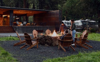
AutoCamp Russian River
From $149 / night
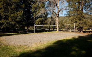
Warm Springs Rec Area
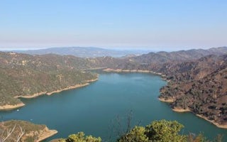
Oak Shores Day Use Area (Ca)
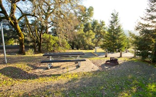
Liberty Glen (Lake Sonoma)


