Ramona, California
Ramona, California is a great place for outdoor adventurers! With its scenic trails, rolling hills, and great weather, there are plenty of activities and attractions to explore. For those looking for a memorable visit, there are plenty of trails for hiking, biking, and running. The area is also known for its great camping spots, and there are many areas to explore with family and friends. For a unique experience, visitors can also take advantage of the local horseback riding trails. With a wealth of activities and attractions, Ramona, California is a top spot for adventurers of all kinds.
Top Spots in and near Ramona
-
Escondido, California
Clevenger Canyon South West Trail
5.04.39 mi / 1099 ft gainClevenger Canyon South West Trail located in San Diego is a moderately challenging 4.4-mile round-trip hike with expansive views of the San Pasqual Valley and surrounding peaks. Located near the northern edge of the Clevenger Canyon area, the trail takes you through open, exposed terrain with ste...Read more -
Ramona, California
Mount Woodson's East Approach
3.03.96 mi / 1385 ft gainMount Woodson is a well-known hiking trail in San Diego County. It is known for its breathtaking views and the famous potato chip rock. The Trail on the east side of the Mountain is fairly steep but is about half the distance of the trail on the west side of the mountain. To get to the trail on ...Read more -
Ramona, California
Explore the Sutherland Dam
2.01 miOnce your on Sutherland Dam Rd, follow it until your right next to the dam. Park on the side of the road where you see a small turn-out. Walk down to the side of the dam and drop down onto the concrete flooring of the dam. Walk on-top where allowed, and check out the views of the lake and the mo...Read more -
Ramona, California
Cedar Creek Falls
4.85.52 mi / 1024 ft gainThe trail to Cedar Falls starts out at a hill in a residential area and ends in an unexpected spot where there is a beautiful waterfall complete with a swimming hole. Surrounded by 75-foot-high cliffs, a magnificent waterfall splashes into a pool known as the Devil’s Punch Bowl. Hikers have been ...Read more -
Ramona, California
Iron Mountain Peak Trail
4.15.67 mi / 1030 ft gainIron Mountain is the longest wilderness trail in Poway, CA. The parking lot is free and provides bathroom and water fountain amenities. The distance from the parking area to the summit is approximately 3.2 miles. Beginning with a wide smooth trail, slowly transitioning into semi-technical incline...Read more -
Poway, California
Mount Woodson and Potato Chip Rock
4.66.45 mi / 1965 ft gainMt. Woodson is located in Poway's most eastern region and is one of San Diego's most popular and most iconic hiking trails. Known for its grand photo opportunistic "Potato Chip Rock", Mt. Woodson is a 7.5mi out-and-back trail with amazing vistas, convenient rest stops and breathtaking views. The...Read more -
Poway, California
Lake Poway
4.0It costs $5 to enter the park and they are open 6am to sunset everyday. There is plenty of parking and this park is huge! This place has so many outdoor recreational activities such as fishing, hiking, running, archery, feeding ducks, or just having a picnic. With so many possibilities in this o...Read more -
Lakeside, California
Hike El Cajon Mountain
4.512 mi / 4100 ft gainThis challenging trek is a great way to get in shape for that spring or summer trip to the Sierras. You may have heard others tell you how tough the hike is and they're not kidding. You'll be gaining 4100 feet over the 12 miles to the peak and back. If you have the time and the energy, you should...Read more -
Lakeside, California
Hike the Oakoasis Open Space Preserve
2.5 mi / 300 ft gainStarting at the trail-head, head down towards the oak-lined ravine marking the beginning of the hike. With trees already growing back from the 2003 fire, these sections of the trail are nice and shady, and quite relaxing. About 1 mile in you will start to see the San Vicente Reservoir to your lef...Read more -
Poway, California
Blue Sky Ecological Reserve to Ramona Dam
3.05.3 mi / 984 ft gainStarting at the trail head where you park your car, head south along the Green Valley Truck Trail. After less than a mile, you will notice the city and noise start to fade behind you, and a beautiful sight of towering oaks, willows, and sycamores appear as you walk along the Creekside Trail. You ...Read more -
Poway, California
Hike around Goodan Ranch
5.03 miStarting at the Sycamore Canyon Trail head, you will see the sign and gate that leads to Goodan Ranch. Head down the gravel road for 1.1 miles, until you reach a 3-way directional split. Heading straight for another .5 miles will take you directly to the ruins of the old Goodan house. Here you wi...Read more -
Poway, California
Catch a Sunset at Twin Peaks Mountain
2 miStart by parking at Silverset Park. You will see the trail head for Twin Peaks just behind the park. Park outside of the park if you think you'll be staying past sunset, as the park gates close at dark! Once you spot the trail head, veer left to the path heading up towards the peaks. You will eve...Read more -
San Diego, California
Battle Mountain's Cross
5.00.45 mi / 256 ft gainThis is a quick and easy hike for everyday explorers desiring a 20-minute sweat-inducing power walk leading to incredible views of urban development, Iron Mountain, Mt. Woodson, Mule Hill, and The 15. Come enjoy the views while sitting under the beautiful 20ft cross you've been admiring from the ...Read more -
Escondido, California
Bernardo Mountain Summit Trail
5.07.15 mi / 1060 ft gainBernardo Mountain is located on the Coast to Crest Trail in San Dieguito River Park. The 7.15-mile out-and-back trail to the 1060 ft. summit starts on the east side of I-15. It's a relatively easy hike all the way to the top. It picks up a little once you make it to the Summit Trail junction, wh...Read more -
Santa Ysabel, California
Three Sisters Falls
4.93.42 mi / 906 ft gainThree Sisters Falls is by far the best hike, for the most reward, that I've gone on in the close vicinity of San Diego. Only a short hour and a half drive from downtown San Diego, the hike offers all the draws of a National Park: remote wilderness, strenuous hiking, scenic mountain views, and ama...Read more -
Santa Ysabel, California
West Vista Loop
5.04.21 mi / 886 ft gainThe West Vista Loop in Santa Ysabel, CA, is a moderately challenging trail known for its panoramic views of surrounding hills and valleys. Reviewers appreciate the well-maintained paths and gentle elevation gains, making it suitable for hikers of varying skill levels. The trail is dog-friendly ...Read more
Camping and Lodging in Ramona
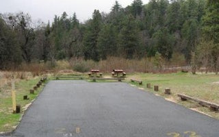
Palomar Mountain, California
Observatory Campground
Overview
Science buffs and families are drawn to Observatory Campground for its proximity to the Palomar Observatory, a world-class cente...
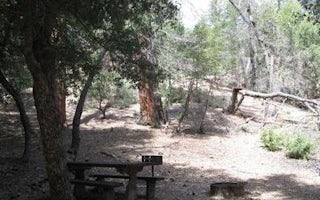
Palomar Mountain, California
Fry Creek Campground
Overview
Fry Creek Campground is situated in the heart of Cleveland National Forest, uniquely located down the road from the world-famous...
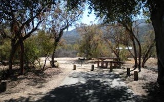
Warner Springs, California
Oak Grove Campground
Overview
Located on the Cleveland National Forest, Oak Grove Campground is nestled in a valley of large oak groves and manzanita.Recreati...
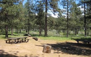
Laguna Meadow Road
El Prado Group
Overview
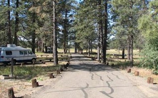
El Prado Group Campground is a great mountain getaway just one hour east of San Diego, California in the Laguna Mountain Recreat...
Mount Laguna, California
Laguna
Overview
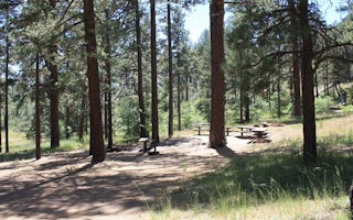
Laguna Campground is a great mountain getaway just one hour east of San Diego, California in the Laguna Mountain Recreation Area...
Mount Laguna, California
Horse Heaven Group
Overview
Contrary to its name, Horse Heaven Group Campground has no equestrian sites. Instead, this tent-only facility can accommodate ga...


