
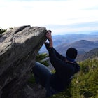
Base of DeSoto Falls Trail
Mentone, Alabama
Details
Distance
1.15 miles
Elevation Gain
259 ft
Route Type
Out-and-Back
Description
Added by Mark Friedman
The Base of DeSoto Falls Trail is the trail less traveled to this waterfall. You'll scramble your way over rocks, fallen trees and thick brush to the base of DeSoto Falls.
The main visitor entrance to DeSoto Falls in Mentone, AL provides easy, paved trails along the upper rim of the falls. For a more private an intimate view, there is a pull off on the side of the road and trail access. Heading south on AL Hwy 89, take a left turn on Dekalb Country Road 613. After a half mile there is a small pull off that fits a couple cars. If you see a large boulder and power lines you are in the right place. This difficult to follow trail is seldom traveled on, so keep your bearings and if you get stuck/lost, head down to the river and just follow it upstream to the falls.
Making the less than 1 mile trek at sunrise and in the rain didn't help, but the view and sandwich (bring your own) at the base of the falls is worth it. Look out for a pond about 30 minutes away on your drive back for a spectacular display of lilly pads and aquatic life.
Download the Outbound mobile app
Find adventures and camping on the go, share photos, use GPX tracks, and download maps for offline use.
Get the appFeatures
Base of DeSoto Falls Trail Reviews

This is one of my favorite spots in northeast Alabama. Hiking down to the base of the falls is well worth it and pretty simple. In regards to the other reviews about the difficulty in finding the trail - they’ve recently added signs that take you directly to the base of the waterfall, so don’t worry about that anymore. I will definitely be taking my kayak next time to paddle around under the falls.
5.0
100% Recommend going down to the base of the falls vs the view from the top (Assuming you only have time for one, otherwise why not do both haha). One big piece of advice I will give to add to the directions, as everyone else has said getting there can be a bit tricky, one major thing to note is that at the pull off, yes there are power lines and it's a small dirt/scattered gravel pull off, but the boulders mentioned aren't as noticeable from where I parked, so don't feel like you're in the wrong place if from the pull off you don't see a massive boulder. So KEY THING: from the pull-off there are TWO trails that have been worn, one is a bit more obvious and leads to the left, this is the WRONG path. The path you want to take is the one that goes down the hill next to the pull off, when I went I thought the left path would eventually go downhill, it does not. But it does eventually lead to a really cool upper vantage point of the falls if you want to check that out! But if you are wanting to go straight to the base of the falls; take the path that from the pull off immediately starts going downhill. A friend and I strung up some Eno's down at the base of the falls on a few trees and enjoyed the area for a few hours. 5/5 Great adventure, and the detour we took just made it all the more fun for us, great views!
5.0

If you are up for the challenge, lug a kayak to the base of DeSoto Falls. Its tough so be prepared and bring friends to help. It is completely worth being able to paddle right up to the massive chute of water!
5.0

The waterfall itself is fantastic. Can feel commercialized if you're just going to hang at the top of the waterfall. However, going to the base of the waterfall is well worth it. Can be tricky to find the trail at times, but like the description says, following the river will lead you there. Definitely suggest to go down to the bottom.
4.0
Leave No Trace
Always practice Leave No Trace ethics on your adventures and follow local regulations. Please explore responsibly!
Nearby
")
Swim at Little Falls (Martha's Falls)

Little River Falls

Little River Canyon

Hike the Marble Mine Trail

Camp at Cloudland Canyon State Park

Hike Sitton's Gulch Trail
Community
Mobile Apps

© 2025 The Outbound Collective - Terms of Use - Privacy Policy