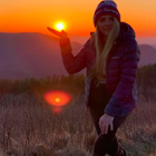
Max Patch Mountain
Del Rio, Tennessee
Details
Distance
1.51 miles
Elevation Gain
315 ft
Route Type
Loop
Description
Added by Justin Costner
Max Patch Mountain offers 360 degree vistas of Great Smoky Mountains and Black Mountains.
Max Patch Mountain was once cleared for pasture land, leaving an expansive flat summit that now serves as the ideal location for a picnic hike, flying a kite, or laying in the sun surrounded by the Great Smoky Mountains. With little elevation gain and a short distance it is also very family (and dog!) friendly.
A section of the Appalachian Trail crosses right over the bald so keep an eye out for rugged looking looking backpackers who are tackling the AT trek. This also means there is potential to camp/backpack this area, although not on the Max Patch bald itself. Take the AT in either direction and you'll find places to camp without going more than a mile or two.
Getting There
To find the trailhead from Asheville, head out of town on NC-63 W. Drive 31 miles, turn right on NC 209, staying on for a 1.7 miles then making a series of quick turns; left on Caldwell Mountain Road; right on Meadow Fork Road; left on Little Creek Road; and finally a right onto Max Patch Road. A couple miles up Max Patch Road, look for a large parking lot on the right side of the road. There is an obvious trail leading away from the road and up to Max Patch Mountain.
Download the Outbound mobile app
Find adventures and camping on the go, share photos, use GPX tracks, and download maps for offline use.
Get the appFeatures
Max Patch Mountain Reviews
Very easy hike. Great for families. You can see the top from parking below. Expect tons of crowds.
5.0
One of the most breathtaking sunsets I have ever seen was at Max Patch. Worth the haul up the gravel road.
5.0
This place is truly amazing and holds a special place in my heart. Although camping is not specifically allowed enough people do it that its basically allowed.
5.0
Max Patch is a summertime favorite. You can usually expect to see plenty of other campers on a clear night. Its actually a really great atmosphere if you're wanting to socialize with other like-minded folks.
5.0
this has got to be one of my favorite places to camp. it's not a long or strenuous hike to the top so you can bring more comfort items! the view from the summit is absolutely unforgettable! you can get an amazing sunset and sunrise all in the same campsite because of the 360 degree view from you there. it is a rough road up however so make sure to drive something capable to handle the gravel road.
5.0
This is a very quick hike from the parking area (very different than arriving via the AT) - the elevation is intense for just a moment before you crest onto the bald and then the views hit you. 360 degrees of rolling mountains, right in the middle of the Appalachian Trail. Take a picnic or a kite. Camping is allowed here - just be sure to get to your spot early before other campers arrive - and be prepared to hike to dig your cathole. Bring warm clothes. If you come during winter months, don’t be disappointed if there’s a surprise snow that blots out your view - the whiteout is another staggering form of beauty to take in.
5.0
Leave No Trace
Always practice Leave No Trace ethics on your adventures and follow local regulations. Please explore responsibly!
Nearby
Max Patch to Hot Springs, N.C. via Appalachian Trail
Hike to Little Fall Branch falls
Photograph the Smokies from Buzzards Roost
Hike to Mt. Sterling's Fire Tower
Mouse Creek Falls
Whitewater Rafting the Pigeon River
Community
© 2025 The Outbound Collective - Terms of Use - Privacy Policy


