Hart's Location, New Hampshire
Top Spots in and near Hart's Location
-
Bartlett, New Hampshire
Hike Mt. Carrigain
5.010 mi / 3250 ft gainPark on Sawyer River Road at the Signal Ridge Trailhead. Trail starts out as a mild climb and meanders with the Whiteface Brook. When you arrive at the Carrigain Notch Trail junction, turn left. Enjoy three miles of steep uphill along the mountain's edge. When you reach the the apex of Mt. Carrig...Read more -
Hart's Location, New Hampshire
Hike Mt. Crawford
5.05 miDon't let the relatively short 2.5 mile hike up Mt. Crawford fool you, you certainly work for the amazing views from the summit. Located in Crawford Notch, park in the Davis Path lot almost directly across from the Notchland Inn on Rt. 302. The trail starts by going over a footbridge crossing the...Read more -
Arethusa Falls Road, New Hampshire
Snowshoe to Arethusa Falls via Bemis Brook Trail
2.8 mi / 853 ft gainArethusa Falls is a popular hike in the White Mountains, and come winter it is a popular spot for ice climbing. The falls are located in Crawford Notch State Park and is the tallest waterfall in New Hampshire (between 140-200 feet). Following the Bemis Brook Trail to Arethusa Falls will add a few...Read more -
Hart's Location, New Hampshire
Hike to Frankenstein Cliffs
4.35 mi / 1400 ft gainThe Frankenstein Cliff trailhead is located in Crawford Notch State Park directly off of Route 302. If you're traveling from the south (Bartlett/North Conway) the parking lot for the trailhead is on your left hand side about 12 miles from Bartlett. There are signs for Arethusa Falls/Frankenstein ...Read more -
Hart's Location, New Hampshire
Rappelling at Ripley Falls
1.5 mi / 0 ft gainThis is a once-in-a-lifetime adventure to rappel down a 100+ waterfall surrounded by beautiful scenes in the midst of the White Mountains. This adventure is organized and facilitated by Northeast Mountaineering who provide gear, guidance, and safety instruction. You will begin your day at the Bu...Read more -
Waterville Valley, New Hampshire
Sabbaday Falls
4.70.7 mi / 171 ft gainThis awesome waterfall is located right off of the Kancamagus Highway (rt 112) that runs from Lincoln to North Conway, NH. The highway itself is a very scenic drive through the White Mountains that has pull off spots every couple of miles. From I93 take exit 32 for Lincoln. Drive straight throug...Read more -
Albany, New Hampshire
Rocky Gorge Scenic Area Loop
2 mi / 266 ft gainA beautiful area of the Kancamagus Highway, the Rocky Gorge section is home to rushing rapids and scenic lakes. When visiting in the fall the colors are amazing however be ready for traffic and more crowds. This location has a parking lot and walking trails along the river to multiple viewpoints.Read more -
Albany, New Hampshire
Champney Falls - Bolles Chocura Loop
5.09.18 mi / 2904 ft gainChampney Falls - Bolles Chocura Loop is a loop trail that takes you by a waterfall located near Lincoln, New Hampshire.Read more -
Lincoln, New Hampshire
Osceola Mountain via Greeley Pond
4.06.8 mi / 2677 ft gainStart out at the Greeley Pond trailhead off of the Kancamagus Highway. After 1.3 miles the trail splits--bear right to get onto the Mt. Osceola Trail. Continue 1.5 miles to the summit. This summit hike offers a different kind of reward. Views are limited from the peak of Mt. Osceoloa, which allow...Read more -
Lincoln, New Hampshire
Summit Mount Hancock and South Hancock
9.8 mi / 2220 ft gainThe Hancock trailhead is located at the infamous hairpin turn of the Kancamagus Highway in the White Mountains. The trail itself crosses the road and starts at 2000 feet of elevation on the Hancock Notch trail. It remains fairly flat for the first 3 miles of the trail. After 1.8 miles you will hi...Read more -
Bartlett, New Hampshire
Cathedral Ledge
4.00.31 mi / 95 ft gainDuring spring, summer and fall there is a road that allows you to drive to the top of Cathedral Ledge. In winter the road is closed off to vehicles so reaching the top requires a 1.7 mile hike. Once at the top, there is a fenced in lookout with a 180 degree view of North Conway and the surroundin...Read more -
Conway, New Hampshire
Diana's Baths
5.01.33 mi / 190 ft gainDiana's Baths is an out-and-back trail that takes you by a waterfall located near North Conway, New Hampshire.Read more -
Crawford Notch Road, New Hampshire
Snowshoe Mount Jackson
5.2 mi / 2300 ft gainThe hike starts across the street from the AMC Highland Center on route 302, which means there is plenty of parking and when you finish there is a fireplace and snacks to warm up with! It starts at the Webster Jackson trailhead and after 1.4 miles breaks off onto the Jackson trail. At that point ...Read more -
Jackson Webster Trail, New Hampshire
Hike Mount Jackson
4.5 mi / 2109 ft gainThe Jackson Webster trailhead is located on Crawford Notch Road a little ways down from the AMC Highland Center where they have bathrooms, food, a store, info, etc. There's a parking lot at the Center as well as a smaller lot right across from the trailhead. These lots often get filled up but you...Read more -
Crawford Notch Road, New Hampshire
Hike to the Summits of Mt. Jackson and Mt. Pierce
8 mi / 5000 ft gainFrom I93 take exit 35 onto rt 3. Follow that until you get to a four way intersection. Take a right onto rt 302 and follow that until you see an AMC information building on the right. Drive past the parking lot about 500 feet and park on the left right after the lake.From there take the Webster ...Read more -
Crawford Notch Road, New Hampshire
Snowshoe Mount Pierce
6.4 mi / 2500 ft gainThe hike begins right across from the AMC Highland Center, which is great because you can utilize their spacious parking lot! Once you locate the trailhead, the elevation begins almost immediately. Begin on the Crawford Connector Trail for 0.4 miles.You will come to a foot bridge over Gibbs Brook...Read more
Top Activities
Camping and Lodging in Hart's Location
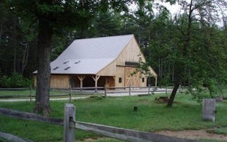
Albany, New Hampshire
Russell Colbath Barn
Overview
This site does not take reservations.
Recreation
Facilities
Natural FeaturesNearby Attractions
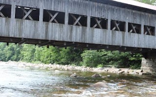
Albany, New Hampshire
Covered Bridge
Overview
Covered Bridge Campground is located in a thick forest along one of the most scenic drives in New Hampshire. This facility provi...
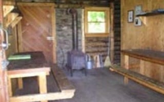
Jackson, New Hampshire
Doublehead Cabin
Overview
Doublehead Backcountry Cabin is accessible only by hiking, snowshoeing or skiing the 1.8-mile Doublehead Ski Trail. Guests shoul...
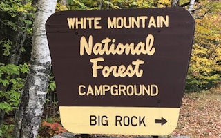
Lincoln, New Hampshire
Big Rock
Overview
Big Rock Campground has 28 individual wooded sites, each with a picnic table, tent pad and turnout for parking. Eight sites shar...
Albany, New Hampshire
White Ledge Campground
Overview
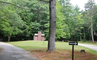
White Ledge Campground is conveniently located off State Route 16, 5 miles south of the town of Conway, New Hampshire. It is a r...
Tripoli Road
Osceola Vista Campground
Overview
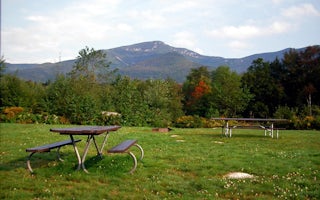
Osceola Vista is a popular spot for group camping and is located near a host of outdoor activities, including hiking, mountain b...


