Gorham, New Hampshire
Top Spots in and near Gorham
-
Gorham, New Hampshire
Hike the Imp Face Trail
6.1 mi / 2080 ft gainStart a few miles north of the Joe Dodge Lodge and Pinkham Notch. If starting in Gorham, the trailhead is 6-8 miles south and will be on the east side of the road. Starting at about 1000 ft, hike in about 5 miles and 5 miles back to beginning. Two routes back, both about the same distance.Startin...Read more -
Randolph, New Hampshire
Hike the Northern Presidentials
15.6 miThe Presidential Range is a mountain range located in the White Mountains of New Hampshire. They contain the highest peaks of the Whites and are named after Presidents of the U.S. I also want to add that this range is known for having some of the worst weather in America, mainly because of the un...Read more -
Gorham, New Hampshire
Backpack to Osgood Tentsite and Hike Mount Madison
5.09.3 mi / 4521 ft gainBegin at Great Gulf Trailhead (located on the west side of NH Route 16, about 1.5 mi. south of the junction with Dolly Copp Rd.) which offers a large fee for parking lot. Bring cash and pay at the self service pay station then display your receipt in car. Walk towards the back of the parking lot ...Read more -
Gorham, New Hampshire
Snowshoe to Carter Notch Hut
7.8 mi / 2200 ft gainThe nineteen mile brook trail is a winding path up approximately 2200 feet of elevation over the course of 3.9 miles. That distance feels a lot farther when you are breaking trail in 18-24 inches of snow and you are carrying 35 lb packs on your backs. Luckily we started out early and we able to ...Read more -
Randolph, New Hampshire
Madison Spring Hut to Lake of the Clouds Hut via Gulfside Trail
5.06.76 mi / 2441 ft gainMadison Spring Hut to Lake of the Clouds Hut via Gulfside Trail is a point-to-point trail that provides a good opportunity to view wildlife located near Randolph, New Hampshire.Read more -
Jackson, New Hampshire
Drive Mt. Washington Auto Road
3.0Starting at roughly 3,000ft above sea level the Mt. Washington Auto Road will take you up nearly eight miles of beautiful, scenic, and well maintained mountain auto roads to The Mount Washington Summit. The summit sits at 6,289 and offers stunning 360° views of New Hampshire's Presidential Range,...Read more -
Jackson, New Hampshire
Hike Tuckerman's Ravine Trail on Mt. Washington
4.99 miWhile this trail is open year round with winter hiking/skiing down the ravine walls, this entry will focus on hiking in the warmer months.Your hike starts behind the Pinkham Notch AMC Center in Jackson, NH at an elevation of approximately 2050 ft. There is plenty of parking at the visitors cente...Read more -
Jackson, New Hampshire
Winter Ascent of Mt. Washington Via Lion Head Trail
8 mi / 4200 ft gainPark at the Pinkham Notch visitor center off of Route 16, your stopping point for all things Tuckerman’s Ravine and Mt. Washington related. The ranger station is open year round and there is food and up to date weather conditions from the summit. There is also a locker room with showers available...Read more -
Jackson, New Hampshire
Lake of the Clouds from Mount Washington Summit via Crawford Path
5.02.81 mi / 1224 ft gainLake of the Clouds from Mount Washington Summit via Crawford Path is an out-and-back trail that provides a good opportunity to view wildlife located near Randolph, New Hampshire.Read more -
Randolph, New Hampshire
Summit Mount Jefferson, Mount Clay, and Mount Washington
4.010.5 mi / 4455 ft gainHike with at least one other and take two cars. First drop one car at the Cog Railway parking lot (Base Station Rd, Bretton Woods, NH). Jump into the second car and drive about 15 minutes to the Caps Ridge Trailhead on Jefferson Notch Road ( N 44° 18' 15"W 71° 21' 42" )The Caps Ridge Trail will l...Read more -
Randolph, New Hampshire
Hike Mount Jefferson
5 mi / 2700 ft gainMount Jefferson stands at 5712 feet, the third tallest mountain of the Presidential's in the White Mountain National Forest. The trail head begins at the Caps Ridge Trail on Jefferson Notch Rd. While 2.5 miles sounds easy, this hike is not for the once in while day hiker. Challenging rock scrambl...Read more -
Thompson and Meserves, New Hampshire
Hike Mt. Washington via Ammonoosuc Ravine Trail and Jewell Trail
5.07.4 mi / 3720 ft gainTo begin this hike, drive to Marshfield Station on Base Station Road in Jefferson, NH. There are several large parking lots capable of holding both hiker and Cog Railway traffic even on busy days. Parking in the lots at the Marshfield Station costs $5.00/day, there is a lot for hiker parking at t...Read more -
Stow, Maine
Rattlesnake Pool
2.11 mi / 207 ft gainThe best place to start your hike is from Route 113 near Gilead, head towards Stone House Road. This becomes Shell Pond Road. A few miles in, you'll find a gated area where you can park. This trail, and Rattlesnake Pool, are both on private land - so be sure to practice leave no trace principles.Read more -
Jefferson, New Hampshire
Mount Waumbek via the Starr King Trail
5.06.58 mi / 2720 ft gainThe hike starts out at the Starr King trailhead because you will summit Starr King Mountain (3,907 ft - so close to being a 4000 footer!) before moving on to Waumbek. The 2.6 miles that it takes to get to the first summit are gradual and forgiving. The majority of the total elevation is completed...Read more -
Carroll, New Hampshire
Hike Mt. Pierce
5.06.2 mi / 2412 ft gainMount Pierce (elevation 4312 ft.) is part of the Presidential Region in the White Mountain National Forest. Upon reaching the summit, you will be rewarded with 360 degree views of the surrounding mountains. To begin your hike, park at the Crawford Connector Trailhead. You will follow the Crawfo...Read more -
Jackson Webster Trail, New Hampshire
Hike Mount Jackson
4.5 mi / 2109 ft gainThe Jackson Webster trailhead is located on Crawford Notch Road a little ways down from the AMC Highland Center where they have bathrooms, food, a store, info, etc. There's a parking lot at the Center as well as a smaller lot right across from the trailhead. These lots often get filled up but you...Read more
Top Activities
Camping and Lodging in Gorham
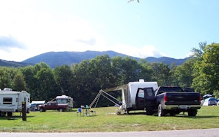
Gorham, New Hampshire
Dolly Copp
Overview
Located 6 miles south of Gorham, New Hampshire at the base of New England's tallest peak, the historic Dolly Copp Campground is ...
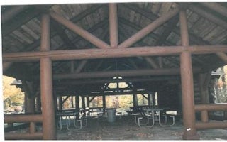
Gorham, New Hampshire
Dolly Copp Picnic Pavilion
Overview
Located along the Peabody River in the heart of the White Mountains, the Dolly Copp Picnic Pavilion is a wonderful location for ...
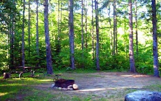
Bethel, Maine
Hastings Campground
Overview
Hastings Campground is located on Route 113 near the shore of Evans Brook in western Maine. It is situated in a rustic and remot...
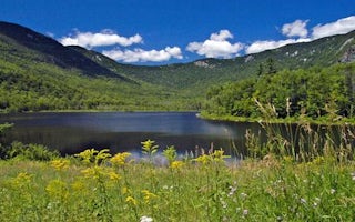
Chatham, New Hampshire
Basin Campground
Overview
Basin Campground is located in a rustic, remote part of White Mountain National Forest in New Hampshire, about 15 miles north of...
Jackson, New Hampshire
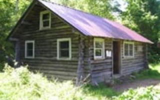
Black Mountain Cabin
Overview
Black Mountain Backcountry Cabin was built in the 1930s by the Civilian Conservation Corps and sits on what was once pasture lan...
Chatham, New Hampshire
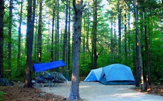
Cold River
Overview
Cold River Campground is located in a rustic, remote part of White Mountain National Forest in New Hampshire, about 15 miles nor...


