Gold Canyon, Arizona
Top Spots in and near Gold Canyon
-
Apache Junction, Arizona
Monument Canyon and Broadway Cave
3.63.69 mi / 866 ft gain...Who doesn't enjoy a short adventure to an scenic location?! If I were to guess, I'd say a good majority of us. This four mile, low trafficked hike to the Broadway Cave will lead you to one of the best spots to hang out or watch the sunset. The Broadway trailhead is located by taking Highway 60...Read more -
Gold Canyon, Arizona
Peak 5057 via Hieroglyphic Trail
5.07.45 mi / 3045 ft gainTo get to the trailhead from US60, turn north onto Kings Ranch Road where you will begin the winding path through the neighborhoods. From Kings Ranch Road, turn east on Baseline Ave, north on Mohican Road, west on Valley View Drive, north on Whitetail Road, and east on Cloudview Ave until it com...Read more -
Gold Canyon, Arizona
Hieroglyphic Trail
5.02.9 mi / 614 ft gainThis hike is a great beginner hike for those who want to experience the beauty of the Superstitions. I suggest going early in the morning because this trail gets very crowded later in the day (especially on weekends). To get to the trailhead from US60, turn north onto Kings Ranch Road where you ...Read more -
Gold Canyon, Arizona
Superstition Peak 5057 via Carney Springs
5.07.71 mi / 2831 ft gainThis is the true beast hike of the Superstitions. If you think Flatiron is a toughy, give this a whirl! You will be poked, prodded, slapped, smacked, jolted, tripped and stabbed the entire way, but rewarded with arguably the finest sights the valley of the sun has to offer: the entire Superstitio...Read more -
Gold Canyon, Arizona
Catch a Sunset at Three Sisters
5.0Three Sisters is a huge rock formation in the southern area of the Superstition Mountains. This spot is only about an hour outside of Phoenix and it's a great spot to do photography in the evening or morning.This is accessed from the Wave Cave parking lot on the way to the nearby Peralta Trailhe...Read more -
Gold Canyon, Arizona
Wave Cave Trail
4.73 mi / 948 ft gainFrom the trail-head you will follow the old and wide dirt road for a while until you reach the wilderness fence line. It's easy to get lost. When you reach the fence there's an area to go through. It's difficult to see. Make sure you look closely. DO NOT follow the signs that say "trail". Once yo...Read more -
Apache Junction, Arizona
Catch a Sunset at Goldfield Ranch
4.0Although a tourist trap, Goldfield Ghost Town is a place any visitor might like stopping for a little food and a drink if they're hiking in the Superstition Mountains at the nearby Lost Dutchman State Park. It's certainly a place that has plentiful opportunities for some photography.While there y...Read more -
Apache Junction, Arizona
Hike to Praying Hands in Lost Dutchman State Park
4.04.3 mi / 954 ft gainBegin your hike in the Cholla parking lot, and start Treasure Loop Trail (this is the north side of the loop, heading east). Once you get to the base of the main cliffs, and the trail starts to veer to the right, this is where you branch off. Instead of veering right, go straight and off to the...Read more -
Apache Junction, Arizona
Photograph Cactus Blooms at Lost Dutchman
4.5And there is no better place to experience this beautiful display than at Lost Dutchman State Park. The State Park website shares that visitors can find "chuparosas, poppies, fiddle necks, globe mallow, chuparosa, brittle bush, desert evening primrose, lupine, ocotillo, chicory, scorpion weed, sk...Read more -
Apache Junction, Arizona
Siphon Draw to Flatiron Summit
4.95.6 mi / 3415 ft gainFlatiron is one of the most popular day hikes in the Superstition Wilderness, just outside of Phoenix, AZ. The hike begins at Lost Dutchman State Park in Apache Junction. Once inside the park, drive to the last parking area and look for a sign for the Siphon Draw Trailhead. The Siphon Draw Trail ...Read more -
Apache Junction, Arizona
Treasure Loop Trail
4.82.34 mi / 571 ft gainLocated about 40 miles east of Phoenix right off AZ-88 E/N Apache Trail. The initial trail begins at an elevation of 2000 feet within the Sonoran Desert. The trail can be accessed via the Cholla (northern side) Day-use Area or the Saguaro (southern) Day-use Area. Once you're on the trail you wil...Read more -
Apache Junction, Arizona
Camp at Lost Dutchman State Park
4.8Lost Dutchman State Park is located near the Superstition Mountains in central Phoenix, about 40 miles from Phoenix. There is a $7 day use fee to enter the park, which is waived if you’re camping ($15/night). The park offers 134 campsites, each with a picnic table, barbeque grill, and fire pit, a...Read more -
Apache Junction, Arizona
Drive Through The Apache Trail
4.8Its about a 40 minute drive to the beginning of the trail from Phoenix, and the trail itself is close to a two hour drive, if you don't plan on stopping along the way. The beginning of the trail really begins at the Superstition Mountains, you'll see a sign that says you are entering the Tonto Na...Read more -
Gold Canyon, Arizona
Weavers Needle
8.02 mi / 2602 ft gainLace up your boots, stock up your gear, bid farewell to civilization and head out to the wild. This adventure is not one for the faint of heart. It will scrape, snag, trip and stumble you. It will scare, taunt and tantalize you. You will need to earn this one, and it is more than worth the effort...Read more -
Gold Canyon, Arizona
Fremont Saddle via Peralta Canyon Trail
4.74.53 mi / 1378 ft gainAfter taking Peralta Road all the way to the end, park your car in the parking lot and you'll see the sign for the trail head. Sign in at the register and then begin our hike on Peralta Trail. This trail winds through the canyon and then takes you up switch backs until you reach the saddle. The ...Read more -
Gold Canyon, Arizona
Weavers Needle Loop
5.012.37 mi / 2608 ft gainThis is a difficult hike! Plan on a lot of time and an early start. I did this hike in a clockwise direction (Peralta Trail) which really doesn't matter much but I recommend the direction to get the steepest part of the hike done first. Most people just do an out and back hike to Freemont Saddle ...Read more
Top Activities
Camping and Lodging in Gold Canyon
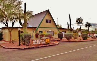
Apache Junction, Arizona
Mesa / Apache Junction KOA Journey
Teddy Roosevelt called the Superstition Mountains "the most beautiful panorama nature has created." You'll see why not far from the Mesa/...
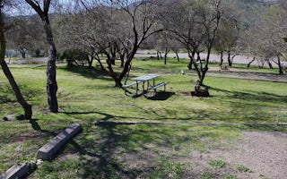
Roosevelt, Arizona
Burnt Corral Campground
Overview
Burnt Corral Campground and Recreation Area (elevation 1914') is about 5.8 miles south of Roosevelt Dam along the Apache Trail (...
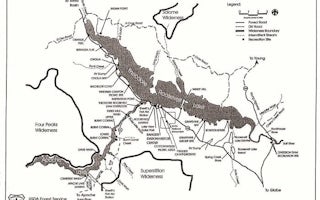
Roosevelt, Arizona
Frazier Group Campground
Overview
The campground overlooks Roosevelt Lake and is nestled in the saguaro cactus-studded Sonoran Desert.Recreation
In addition to ca...
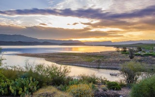
Tonto Basin, Arizona
Cholla Campground
Overview
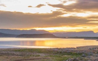
Cholla Campground at Roosevelt Lake, is one of several campgrounds on the shores of the largest lake/reservoir located entirely ...
Roosevelt, Arizona
Windy Hill Campground
Overview
Located on central Arizona's largest lake, Windy Hill offers great water recreation opportunities to the public. Because of its...
Roosevelt, Arizona
Grapevine Group Campground
Overview
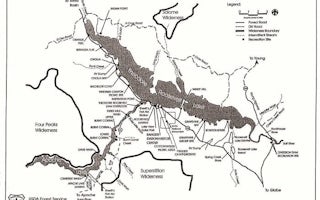
Groups are drawn to Grapevine Campground's unique setting and expansive facilities. The site's location near Roosevelt Lake's sh...


