Cave Creek, Arizona
Top Spots in and near Cave Creek
-
Cave Creek, Arizona
Hike the Go John Trail
5.05.6 mi / 804 ft gainAs you park at the trailhead, you have the option to take this trail in either direction. I recommend that you travel north, which will immediately provide 0.75 miles of elevation gain. You will then reach a pass with panoramic views of the Tonto National Forest. A bench in this area provides the...Read more -
Cave Creek, Arizona
Elephant Mountain Fortress Hike
5.05.5 mi / 867 ft gainThis hike beings at Spur Cross Ranch in Cave Creek, which is a lush riparian area flowing with Saguaros. Starting at the trailhead, you will start this loop by hiking clockwise on Tortuga trail which will connect with the Elephant Mountain trail at 1.5 miles. As you start to ascend the Elephant M...Read more -
Scottsdale, Arizona
Pima and Dynamite Loop
5.050.27 mi / 3983 ft gainPima and Dynamite Loop is a loop trail that provides a good opportunity to view wildlife located near Scottsdale, Arizona.Read more -
Phoenix, Arizona
Apache Wash Loop Trail
5.79 mi / 541 ft gainThis hike begins at the Apache Wash Trailhead where you will find restrooms and a covered rest area. This loop is simple to follow and offers various shortcuts along with an access to an optional summit climb. The loop begins from the north-east end of the parking lot near the restrooms. Turn l...Read more -
Scottsdale, Arizona
Upper Ranch and Brown's Ranch Road Trail
3.98 mi / 154 ft gainUpper Ranch and Brown's Ranch Road Trail is a loop trail where you may see wildflowers located near Scottsdale, Arizona.Read more -
Scottsdale, Arizona
Pinnacle Peak Trail
4.43.87 mi / 896 ft gainPinnacle Peak is a 3.8 mile out-and-back hike along a beautifully groomed trail with a moderate gain of ~1,000ft. This distinctive 600ft granite summit can be seen from most of the surrounding valley and offers spectacular views of the McDowell Mountains, iconic Four Peaks, Granite Mountain and t...Read more -
Phoenix, Arizona
Reach 11 Trail
4.06.3 mi / 118 ft gainLocated in north Phoenix, Arizona, the Reach 11 Recreation Area offers an extensive network of trails winding through 1,500 acres of preserved desert habitat. This urban trail system provides a perfect escape for outdoor enthusiasts seeking adventure within city limits, offering a unique blend ...Read more -
Scottsdale, Arizona
Tom's Thumb
4.33.98 mi / 1280 ft gainThe infamous “thumb” can be seen from most places in the valley – a white burst of rock jutting skyward out of the desert ridgeline. The new Tom’s Thumb Trailhead in 2012 has nice restrooms and offers tons of information about the surrounding rock climbing areas, day hikes and desert knowledg...Read more -
Scottsdale, Arizona
Boulder the Unknown Handcrack near Tom's Thumb
V-easy. 20 feet. Start on the Tom's Thumb Trail about .1 mi. Then take the Mesquite canyon trail left (SE) for .2mi. It will connect with the Feldspar trail. Turn left (E) and continue on until you see the climber access sign. Continue on the well marked trail towards the Girlie Man climbing area...Read more -
Scottsdale, Arizona
Climb Brusin' and Crusin' on Gardner's Wall
This is a 100 foot 5.8 trad climb. Access the Hanging Garden's climbing area off of the Tom's Thumb Trail. About half way up the trail you will see signage for "Rock Climbing Access Route." On the sign you will see an arrow pointing towards Gardner's Wall. This is the direction you want to take. ...Read more -
Scottsdale, Arizona
Climb Girlie Man Near Tom's Thumb
5.9+ 3 bolt slab. About 65ft. To get there you will start on the Tom's Thumb Trail for about .1 mi. Then take the Mesquite canyon trail left (SE) for .2mi. It will connect with the Feldspar trail. Turn left (E) and continue on until you see the climber access sign. Continue on the well marked tra...Read more -
Scottsdale, Arizona
Climb Hanging Garden's on Gardner's Wall
This is a 2 pitch 5.6 trad climb. About 130 feet in total. Access the Hanging Garden's climbing area off of the Tom's Thumb Trail. About half way up the trail you will see signage for "Rock Climbing Access Route." On the sign you will see an arrow pointing towards Gardner's Wall. This is the dire...Read more -
Scottsdale, Arizona
Climb Sphincter Boy Near Tom's Thumb
5.9 trad route. About 60ft. Can be set up as a Top Rope. To get there you will start on the Tom's Thumb Trail for about .1 mi. Then take the Mesquite canyon trail left (SE) for .2mi. It will connect with the Feldspar trail. Turn left (E) and continue on until you see the climber access sign. Cont...Read more -
Scottsdale, Arizona
Marcus Landslide Trail
4.53.77 mi / 561 ft gainNamed after a landslide that scientists say occurred over 500,000 years ago, this interpretive hiking trail in the McDowell Sonoran Preserve is a perfect easy outing for families and nature lovers alike. It begins from the Tom's Thumb trailhead (shared parking lot), which is another beautiful hi...Read more -
Scottsdale, Arizona
Saguaro Loop and Nature Trail
5.01.61 mi / 194 ft gainSaguaro Loop and Nature Trail is a loop trail located near Scottsdale, Arizona.Read more -
Scottsdale, Arizona
Gateway Loop
4.54.32 mi / 764 ft gainThe Gateway Trailhead is one access point into the McDowell Sonoran Conservancy in Scottsdale and is my favorite “Gateway” into the treasure trove of great trails and vistas in the McDowell Mountains. The Gateway Trailhead provides great accessibility for a quick hike or trail run at the end of t...Read more
Top Activities
Camping and Lodging in Cave Creek
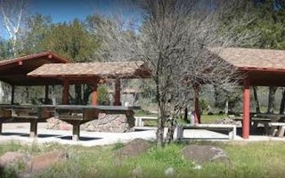
Cave Creek, Arizona
Cave Creek Group Site
Overview
Cave Creek Group Site is located 20 miles north of Cave Creek and Carefree, Arizona. It is a historic campground constructed in ...
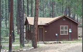
Crown King, Arizona
Horsethief Cabin
Overview
Horsethief Cabin is situated in a clearing of Ponderosa pines at an elevation of over 6,000 feet in the Bradshaw Mountains of th...
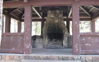
Crown King, Arizona
Turney Gulch Group
Overview
Turney Gulch is a remote, scenic location for groups of up to 100 people to rest under the stars and towering pines of Prescott ...

Mayer, Arizona
Sycamore Cabin
Overview
Sycamore Cabin provides a unique recreation opportunity and lodging experience for visitors to Prescott National Forest. In 1938...
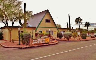
Apache Junction, Arizona
Mesa / Apache Junction KOA Journey
Teddy Roosevelt called the Superstition Mountains "the most beautiful panorama nature has created." You'll see why not far from the Mesa/...
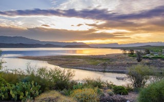
Tonto Basin, Arizona
Cholla Campground
Overview
Cholla Campground at Roosevelt Lake, is one of several campgrounds on the shores of the largest lake/reservoir located entirely ...


